
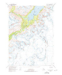
1951 Map of Seward B-5
USGS Topo · Published 1965About this map
Chugach National Forest encompasses this glaciated expanse of the Kenai Peninsula, where the massive Sargent Ice Field feeds a complex network of ice and water. Surveyed in the early 1950s, the map reveals a landscape dominated by tidal and alpine glaciers, including the Ellsworth Glacier and Falling Glacier. These ice bodies descend toward the deep waters of Kings Bay and the drainage basins of the Kings River and Nellie Juan River.
Find a feature on this map
22 named features on this map. Tap any name to fly to it.
Don’t see what you’re looking for? This feature index may not catch every label — zoom into the map to look around manually.
Map Details
Editions of this 1951 Seward B-5 Map
2 editions found
Other maps of this area

1950 · Seward A-6
USGS Topo · 1:63,360

1951 · Seward
USGS Topo · 1:250,000

1951 · Seward A-6
USGS Topo · 1:63,360

1951 · Seward C-6
USGS Topo · 1:63,360

1951 · Seward B-4
USGS Topo · 1:63,360

1951 · Seward C-5
USGS Topo · 1:63,360

1951 · Seward A-5
USGS Topo · 1:63,360

1951 · Seward B-6
USGS Topo · 1:63,360

1951 · Seward A-4
USGS Topo · 1:63,360

1951 · Seward C-4
USGS Topo · 1:63,360