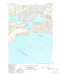
1951 Map of Cordova B-6
USGS Topo · Published 1988About this map
The Heney Range rises sharply above the intricate coastline of eastern Prince William Sound, marking a rugged transition to the Gulf of Alaska. This 1951 survey, revised through the late 1980s, documents the vital maritime and aviation infrastructure of the era, including a landing strip on Hinchinbrook Island and the radio towers at Boswell Bay. The map highlights the interplay of tide and terrain across Orca Inlet and the Strawberry Channel, where features like Mummy I and Seal Rocks punctuate the shifting waters.
Find a feature on this map
33 named features on this map. Tap any name to fly to it.
Don’t see what you’re looking for? This feature index may not catch every label — zoom into the map to look around manually.
Map Details
Editions of this 1951 Cordova B-6 Map
3 editions found
Other maps of this area

1948 · Cordova
USGS Topo · 1:250,000

1950 · Cordova C-7
USGS Topo · 1:63,360

1950 · Cordova C-6
USGS Topo · 1:63,360

1950 · Cordova B-7
USGS Topo · 1:63,360

1951 · Cordova
USGS Topo · 1:250,000

1951 · Cordova C-5
USGS Topo · 1:63,360

1951 · Cordova B-5
USGS Topo · 1:63,360

1951 · Cordova B-6
USGS Topo · 1:63,360

1953 · Cordova C-6
USGS Topo · 1:63,360

1953 · Cordova B-7
USGS Topo · 1:63,360