
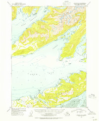
1953 Map of Cordova C-6
USGS Topo · Published 1954About this map
The northern reaches of Hawkins Island and the intricate coastline of Orca Bay define this 1953 coastal survey. Located within the Chugach National Forest, the region is characterized by deep fjords and maritime landmarks that once served as critical navigation points for early Alaskan coastal commerce. Soundings and depth curves reveal the bathymetry of Port Gravina and Sheep Bay, while land-based features are largely limited to geodetic stations and natural landforms. This hydrographic detail reflects the era's reliance on waterborne travel before extensive road networks reached this part of the Alaska coastline. Significant coastal features like Canoe Passage and Orca Inlet mark the transition toward the larger sound, providing a clear record of the shoreline and maritime hazards such as Gatherer Rock and Hanks I as they existed in the early fifties.
Find a feature on this map
34 named features on this map. Tap any name to fly to it.
Don’t see what you’re looking for? This feature index may not catch every label — zoom into the map to look around manually.
Map Details
Editions of this 1953 Cordova C-6 Map
2 editions found
Other maps of this area

1948 · Cordova
USGS Topo · 1:250,000

1950 · Cordova C-7
USGS Topo · 1:63,360

1950 · Cordova C-6
USGS Topo · 1:63,360

1950 · Cordova B-7
USGS Topo · 1:63,360

1950 · Cordova D-7
USGS Topo · 1:63,360

1950 · Cordova D-5
USGS Topo · 1:63,360

1951 · Cordova
USGS Topo · 1:250,000

1951 · Cordova C-5
USGS Topo · 1:63,360

1951 · Cordova B-5
USGS Topo · 1:63,360

1951 · Cordova D-6
USGS Topo · 1:63,360