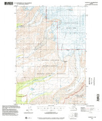
1996 Map of Valdez D-1
USGS Topo · Published 2002About this map
Mt Wrangell Crater dominates the high-elevation landscape of this survey, marking a geological anchor within the Wrangell - Saint Elias National Park. The terrain is defined by massive ice systems, including the Chetaslina Glacier and Cheshnina Glacier, which feed a network of braided waterways such as the Chetaslina River and the East Fork Chetaslina River. This environment illustrates the transition from glacial heights to the forested valleys where a lone Cabin appears along the lower Cheshnina River. The map details the overlapping jurisdictions of the Wrangell - Saint Elias National Preserve and the Wrangell - Saint Elias Wilderness, including the dramatic Cheshnina Falls. Southward, the topography levels slightly toward Clear Creek and Limestone Creek, though the land remains largely untracked by roads or modern development.
Find a feature on this map
22 named features on this map. Tap any name to fly to it.
Don’t see what you’re looking for? This feature index may not catch every label — zoom into the map to look around manually.
Map Details
Editions of this 1996 Valdez D-1 Map
This is the sole edition of this map. No revisions or reprints were ever made.
Other maps of this area

1950 · Nabesna
USGS Topo · 1:250,000

1951 · McCarthy
USGS Topo · 1:250,000

1951 · Gulkana
USGS Topo · 1:250,000

1951 · Nabesna
USGS Topo · 1:250,000

1951 · McCarthy C-8
USGS Topo · 1:63,360

1951 · Valdez C-2
USGS Topo · 1:63,360

1951 · Valdez C-1
USGS Topo · 1:63,360

1952 · Valdez
USGS Topo · 1:250,000

1953 · Valdez C-2
USGS Topo · 1:63,360

1953 · Valdez C-1
USGS Topo · 1:63,360