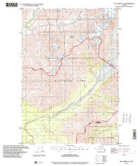
1995 Map of McCarthy C-8
USGS Topo · Published 2001About this map
Glacial valleys and high alpine divides define this portion of the Wrangell Mountains as mapped in the late twentieth century. The terrain is centered on the confluence of the Kluvesna River and Kotsina River, where a prominent landform known as The Peninsula rises between the shifting river braided channels. The map documents a landscape of dramatic vertical relief, stretching from the peaks of Skyscraper Peak and Granite Peak down to the complex drainage basins of the Kuskulana River and Chokosna River.
Find a feature on this map
33 named features on this map. Tap any name to fly to it.
Don’t see what you’re looking for? This feature index may not catch every label — zoom into the map to look around manually.
Map Details
Editions of this 1995 McCarthy C-8 Map
This is the sole edition of this map. No revisions or reprints were ever made.
Other maps of this area

1951 · McCarthy
USGS Topo · 1:250,000

1951 · Valdez B-1
USGS Topo · 1:63,360

1951 · McCarthy C-8
USGS Topo · 1:63,360

1951 · McCarthy B-8
USGS Topo · 1:63,360

1951 · Valdez C-1
USGS Topo · 1:63,360

1952 · Valdez
USGS Topo · 1:250,000

1953 · Valdez C-1
USGS Topo · 1:63,360

1959 · Valdez D-1
USGS Topo · 1:63,360

1959 · McCarthy D-7
USGS Topo · 1:63,360

1959 · McCarthy C-7
USGS Topo · 1:63,360