
1959 Map of McCarthy D-7
USGS Topo · Published 1966About this map
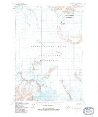
Nabesna Glacier dominates this high-altitude landscape, its massive icy reach marked by numerous crevasses that indicate the slow, steady movement of the terrain. Surveyed in the late 1950s using photogrammetric methods from aerial photographs, the map reflects a purely glaciated environment where the only human-imposed structure is the cartographic Base Line. This area of Alaska remains a study in raw geological power, showing the intricate contouring of ice and high peaks. The 1957 aerial imagery used for this map captures the glacier before more modern shifts in ice movement, providing a specific scientific baseline for researchers studying the historical extent of the ice field and the orientation of the surrounding terrain during the mid-twentieth century.
Find a feature on this map
3 named features on this map. Tap any name to fly to it.
Don’t see what you’re looking for? This feature index may not catch every label — zoom into the map to look around manually.
Map Details
Editions of this 1959 McCarthy D-7 Map
2 editions found
Other maps of this area

1950 · Nabesna
USGS Topo · 1:250,000

1951 · McCarthy
USGS Topo · 1:250,000

1951 · Nabesna
USGS Topo · 1:250,000

1951 · McCarthy C-8
USGS Topo · 1:63,360

1959 · Nabesna A-6
USGS Topo · 1:63,360

1959 · Nabesna A-5
USGS Topo · 1:63,360

1959 · McCarthy C-6
USGS Topo · 1:63,360

1959 · McCarthy C-7
USGS Topo · 1:63,360

1960 · McCarthy D-8
USGS Topo · 1:63,360

1960 · McCarthy D-6
USGS Topo · 1:63,360