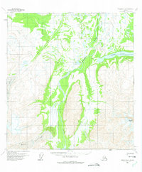
1960 Map of Nabesna B-6
USGS Topo · Published 1975About this map
Copper River serves as the central artery of this high-latitude terrain, where the river's braided channels flow through a landscape defined by glacial movements. To the southeast, Tanada Peak rises as a prominent landmark above the surrounding topography. The presence of both the West Glacier and the Drop Glacier illustrates the significant glacial influence on the local hydrology, feeding into tributaries like Drop Creek. A single Tractor Trail provides the only evidence of overland human transit through these valleys, hinting at the era's reliance on specialized machinery for accessing the interior. To the east, the broad waters of Copper Lake gather at the base of the mountains, marking a transition from the narrow river corridors to wider basins. This survey, based on 1957 aerial photography, captures the interior's geography before significant modern infrastructure reached these specific reaches of the Copper River valley.
Find a feature on this map
7 named features on this map. Tap any name to fly to it.
Don’t see what you’re looking for? This feature index may not catch every label — zoom into the map to look around manually.
Map Details
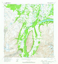
Editions of this 1960 Nabesna B-6 Map
2 editions found
Other maps of this area

1948 · Nabesna C-6
USGS Topo · 1:63,360

1949 · Gulkana C-1
USGS Topo · 1:63,360

1950 · Nabesna
USGS Topo · 1:250,000

1951 · Gulkana
USGS Topo · 1:250,000

1951 · Nabesna
USGS Topo · 1:250,000

1952 · Nabesna C-6
USGS Topo · 1:63,360

1952 · Gulkana C-1
USGS Topo · 1:63,360

1957 · Nabesna C-5
USGS Topo · 1:63,360

1959 · Gulkana B-1
USGS Topo · 1:63,360
1959 · Gulkana A-1
USGS Topo · 1:63,360