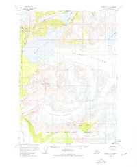
1959 Map of Cordova C-2
USGS Topo · Published 1976About this map
The Copper River corridor dominates this late-1950s landscape, illustrating the difficult engineering required to navigate this glacial terrain. The Million Dollar Bridge stands as a landmark of the era, situated where the river squeezes between the massive Miles Glacier and Miles Lake. The presence of an Old Railroad Grade and sections noted as Under Construction trace the path of historic transport routes attempting to bypass the churning Abercrombie Rapids and the narrow passage of Baird Canyon.
Find a feature on this map
22 named features on this map. Tap any name to fly to it.
Don’t see what you’re looking for? This feature index may not catch every label — zoom into the map to look around manually.
Map Details
Editions of this 1959 Cordova C-2 Map
2 editions found

Other maps of this area

1948 · Cordova
USGS Topo · 1:250,000

1950 · Cordova B-2
USGS Topo · 1:63,360

1950 · Cordova D-3
USGS Topo · 1:63,360

1951 · Cordova
USGS Topo · 1:250,000

1951 · Cordova B-1
USGS Topo · 1:63,360

1951 · Cordova C-3
USGS Topo · 1:63,360

1952 · Cordova B-3
USGS Topo · 1:63,360

1953 · Cordova B-1
USGS Topo · 1:63,360

1953 · Cordova C-3
USGS Topo · 1:63,360

1953 · Cordova B-2
USGS Topo · 1:63,360