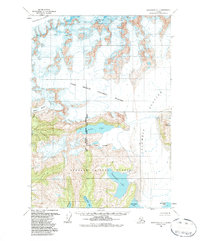
1960 Map of Anchorage A-1
USGS Topo · Published 1987About this map
Columbia Glacier dominates this landscape, its massive ice fields and tributaries carving through the terrain within the Chugach National Forest. The map captures a complex glacial system during the mid-20th century, including the First Branch Columbia Glacier and the distinct Pedro Glacier to the west. This 1960 field-annotated survey provides a significant look at the intersection of the Seward Meridian and Copper River Meridian, showing the alignment of ice and water before decades of documented glacial retreat.
Find a feature on this map
14 named features on this map. Tap any name to fly to it.
Don’t see what you’re looking for? This feature index may not catch every label — zoom into the map to look around manually.
Map Details
Editions of this 1960 Anchorage A-1 Map
3 editions found

Other maps of this area

1948 · Cordova
USGS Topo · 1:250,000

1951 · Seward
USGS Topo · 1:250,000

1951 · Anchorage
USGS Topo · 1:250,000

1951 · Cordova
USGS Topo · 1:250,000

1951 · Seward D-2
USGS Topo · 1:63,360

1951 · Seward D-1
USGS Topo · 1:63,360

1951 · Cordova D-8
USGS Topo · 1:63,360

1952 · Valdez
USGS Topo · 1:250,000

1952 · Seward D-1
USGS Topo · 1:63,360

1952 · Cordova D-8
USGS Topo · 1:63,360