
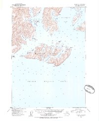
1952 Map of Seward D-1
USGS Topo · Published 1954About this map
Glacier Island dominates this coastal survey within Prince William Sound, showing the intricate shoreline of the Chugach National Forest in the early 1950s. The northern reaches are defined by the massive Columbia Glacier and the protected waters of Columbia Bay and Long Bay. The map documents a sparsely populated maritime landscape where small cabins are the only signs of human habitation, scattered along Irish Cove, Growler Bay, and the southern coast of Glacier Island. This era captures the region prior to major environmental shifts, recording precise soundings and topographic elevations. Geographic landmarks like Bull Head, Iceberg Pt, and Heather Island serve as vital navigational aids for this rugged section of the Third Judicial Division.
Find a feature on this map
40 named features on this map. Tap any name to fly to it.
Don’t see what you’re looking for? This feature index may not catch every label — zoom into the map to look around manually.
Map Details
Editions of this 1952 Seward D-1 Map
2 editions found
Other maps of this area

1948 · Cordova
USGS Topo · 1:250,000

1950 · Cordova C-8
USGS Topo · 1:63,360

1951 · Seward
USGS Topo · 1:250,000

1951 · Anchorage
USGS Topo · 1:250,000

1951 · Cordova
USGS Topo · 1:250,000

1951 · Seward D-2
USGS Topo · 1:63,360

1951 · Seward D-1
USGS Topo · 1:63,360

1951 · Cordova D-8
USGS Topo · 1:63,360

1951 · Seward C-1
USGS Topo · 1:63,360

1951 · Seward C-2
USGS Topo · 1:63,360