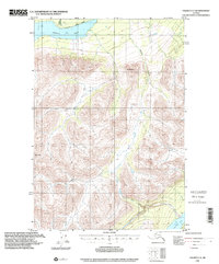
1996 Map of Valdez C-5
USGS Topo · Published 2001About this map
Klutina Lake dominates the northern landscape of this topographic study, where glacier-fed waters collect in the high elevations of the Copper River Basin. Compiled from 1951 topography with 1996 planimetric updates, the map shows a wilderness area defined by steep relief and drainage networks. Massive peaks including Mt Simpson and Bence Mtn tower over the valley floors, funneling water into Chutitna Creek and Manker Creek.
Find a feature on this map
9 named features on this map. Tap any name to fly to it.
Don’t see what you’re looking for? This feature index may not catch every label — zoom into the map to look around manually.
Map Details
Editions of this 1996 Valdez C-5 Map
This is the sole edition of this map. No revisions or reprints were ever made.
Other maps of this area

1948 · Valdez D-5
USGS Topo · 1:63,360

1949 · Valdez D-4
USGS Topo · 1:63,360

1949 · Valdez D-6
USGS Topo · 1:63,360

1950 · Valdez C-6
USGS Topo · 1:63,360

1951 · Valdez D-5
USGS Topo · 1:63,360

1951 · Valdez D-6
USGS Topo · 1:63,360

1951 · Valdez B-5
USGS Topo · 1:63,360

1951 · Valdez C-4
USGS Topo · 1:63,360

1951 · Valdez B-4
USGS Topo · 1:63,360

1951 · Valdez C-5
USGS Topo · 1:63,360