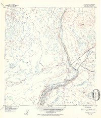
1952 Map of Gulkana C-2
USGS Topo · Published 1952About this map
Chistochina sits at the strategic confluence where the glacial braids of the Chistochina River meet the Copper River. This 1950s-era landscape illustrates the early development of the Glenn Highway corridor, serving as a vital interior link between Anchorage and the Tok Junction. The presence of Sinona Lodge and an adjacent Airstrip highlights the importance of roadside and aerial infrastructure in this part of the Alaska-Third Judicial Division. Beyond the primary transport routes, the terrain is defined by complex hydrological networks, including the winding paths of Sinona Creek, Tulsona Creek, and Boulder Creek. A Gravel Pit near the highway indicates local material extraction used for maintaining these essential northern arteries during the post-war expansion of the territory's road system.
Find a feature on this map
12 named features on this map. Tap any name to fly to it.
Don’t see what you’re looking for? This feature index may not catch every label — zoom into the map to look around manually.
Map Details
Editions of this 1952 Gulkana C-2 Map
2 editions found

Other maps of this area

1949 · Gulkana C-2
USGS Topo · 1:63,360

1949 · Gulkana D-3
USGS Topo · 1:63,360

1949 · Gulkana B-2
USGS Topo · 1:63,360

1949 · Gulkana C-1
USGS Topo · 1:63,360

1950 · Gulkana B-3
USGS Topo · 1:63,360

1950 · Gulkana C-3
USGS Topo · 1:63,360

1951 · Gulkana
USGS Topo · 1:250,000

1952 · Gulkana D-3
USGS Topo · 1:63,360

1952 · Gulkana B-3
USGS Topo · 1:63,360

1952 · Gulkana B-2
USGS Topo · 1:63,360