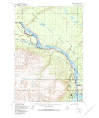
1951 Map of Valdez C-2
USGS Topo · Published 1995About this map
The confluence of the Tonsina River and the braided Copper River anchors this 1951 landscape, showing a region defined by its immense waterways and glacial drainage patterns. The small settlement of Lower Tonsina sits near the western bank, connected to the outside world by the Edgerton Highway, which follows the river's edge toward the southern reaches. This area reflects a mid-century period when the infrastructure of the Copper River basin was transitioning from early mining-related trails to established roadways.
Find a feature on this map
22 named features on this map. Tap any name to fly to it.
Don’t see what you’re looking for? This feature index may not catch every label — zoom into the map to look around manually.
Map Details
Editions of this 1951 Valdez C-2 Map
3 editions found
Other maps of this area

1951 · Valdez B-2
USGS Topo · 1:63,360

1951 · Valdez B-3
USGS Topo · 1:63,360

1951 · Valdez B-1
USGS Topo · 1:63,360

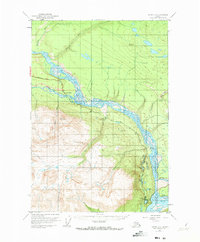
1951 · Valdez C-2
USGS Topo · 1:63,360

1951 · Valdez C-3
USGS Topo · 1:63,360

1951 · Valdez C-1
USGS Topo · 1:63,360

1952 · Valdez
USGS Topo · 1:250,000

1953 · Valdez C-2
USGS Topo · 1:63,360

1953 · Valdez C-3
USGS Topo · 1:63,360

1953 · Valdez C-1
USGS Topo · 1:63,360