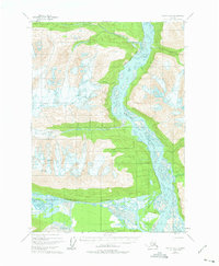
1950 Map of Valdez A-3
USGS Topo · Published 1975About this map
The Copper River dominates this landscape, its braided channels weaving through a corridor of high glacial peaks and deep river valleys as they appeared in 1950. Along the eastern bank, an Old Railroad Grade traces the river's edge, serving as a physical reminder of the early 20th-century transportation routes through this corridor. This industrial footprint contrasts with the massive ice fields of the Schwan Glacier and Cleave Creek Glacier, which remain marked by dangerous Crevasses.
Find a feature on this map
12 named features on this map. Tap any name to fly to it.
Don’t see what you’re looking for? This feature index may not catch every label — zoom into the map to look around manually.
Map Details
Editions of this 1950 Valdez A-3 Map
2 editions found
Other maps of this area

1948 · Cordova
USGS Topo · 1:250,000

1950 · Valdez A-3
USGS Topo · 1:63,360

1950 · Cordova D-3
USGS Topo · 1:63,360

1951 · Cordova
USGS Topo · 1:250,000

1951 · Valdez B-2
USGS Topo · 1:63,360

1951 · Valdez B-3
USGS Topo · 1:63,360

1951 · Valdez B-4
USGS Topo · 1:63,360

1951 · Cordova D-4
USGS Topo · 1:63,360

1951 · Valdez A-2
USGS Topo · 1:63,360

1952 · Valdez
USGS Topo · 1:250,000