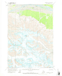
1959 Map of McCarthy C-2
USGS Topo · Published 1969About this map
White River dominates the northern boundary of this high-altitude landscape, where the braided channels of the glacier-fed waterway wrap around North Fork Island. This region is defined by immense glacial movement and extreme vertical relief, anchored by the massive bulk of Mount Sulzer at the center. To the south, the sprawling Giffin Glacier is mapped in meticulous detail, including numerous Crevasses that indicate the active flow of ice through the mountain passes.
Find a feature on this map
9 named features on this map. Tap any name to fly to it.
Don’t see what you’re looking for? This feature index may not catch every label — zoom into the map to look around manually.
Map Details
Editions of this 1959 McCarthy C-2 Map
2 editions found
Other maps of this area

1951 · McCarthy
USGS Topo · 1:250,000

1959 · McCarthy D-1
USGS Topo · 1:63,360

1959 · McCarthy D-3
USGS Topo · 1:63,360

1959 · McCarthy D-2
USGS Topo · 1:63,360

1959 · McCarthy C-3
USGS Topo · 1:63,360

1959 · McCarthy C-1
USGS Topo · 1:63,360

1959 · McCarthy B-2
USGS Topo · 1:63,360

1959 · McCarthy B-1
USGS Topo · 1:63,360

1959 · McCarthy C-2
USGS Topo · 1:63,360

1959 · McCarthy B-3
USGS Topo · 1:63,360