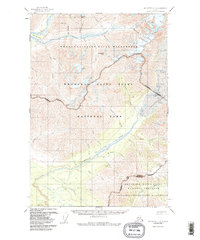
1951 Map of McCarthy C-8
USGS Topo · Published 1987About this map
Glacial landscapes and braided river systems dominate this mid-century survey of the Wrangell Mountains, reflecting a transition in land management between the 1950s aerial photography and the 1980s designation of the Wrangell-Saint Elias National Park. The massive Kuskulana Glacier feeds a complex network of waterways, including the Kuskulana River and Slatka Creek, while high peaks like Granite Peak and Skyscraper Peak anchor the high terrain. Isolated Cabins along the rivers and a single Trail through the Wrangell-Saint Elias Wilderness suggest the sparse, seasonal human presence in this region during the 1950s. The map illustrates the topographic challenges for early travelers, highlighting critical crossings such as Dixie Pass and Kuskulana Pass that connect the Kotsina River drainage to the interior valleys.
Find a feature on this map
37 named features on this map. Tap any name to fly to it.
Don’t see what you’re looking for? This feature index may not catch every label — zoom into the map to look around manually.
Map Details
Editions of this 1951 McCarthy C-8 Map
4 editions found
Other maps of this area

1951 · McCarthy
USGS Topo · 1:250,000

1951 · Valdez B-1
USGS Topo · 1:63,360

1951 · McCarthy C-8
USGS Topo · 1:63,360

1951 · McCarthy B-8
USGS Topo · 1:63,360

1951 · Valdez C-1
USGS Topo · 1:63,360

1952 · Valdez
USGS Topo · 1:250,000

1953 · Valdez C-1
USGS Topo · 1:63,360

1959 · Valdez D-1
USGS Topo · 1:63,360

1959 · McCarthy D-7
USGS Topo · 1:63,360

1959 · McCarthy C-7
USGS Topo · 1:63,360