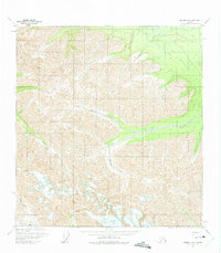
1960 Map of Nabesna B-3
USGS Topo · Published 1975About this map
Winter Trail routes and seasonal passages define this high-altitude Alaskan corridor as it was documented in 1960. The landscape is dominated by a complex network of glacial drainage systems, where watercourses like Antler Creek and Sturer Creek carve through the high elevations between the Copper River and Tanana River basins. Remote transit is the primary human footprint here, visible in the Tractor Trail that skirts the southern margins near Cooper Pass.
Find a feature on this map
14 named features on this map. Tap any name to fly to it.
Don’t see what you’re looking for? This feature index may not catch every label — zoom into the map to look around manually.
Map Details
Editions of this 1960 Nabesna B-3 Map
2 editions found

Other maps of this area

1950 · Nabesna
USGS Topo · 1:250,000

1951 · Nabesna
USGS Topo · 1:250,000

1954 · Nabesna C-3
USGS Topo · 1:63,360

1955 · Nabesna C-2
USGS Topo · 1:63,360

1955 · Nabesna C-3
USGS Topo · 1:63,360

1959 · Nabesna A-4
USGS Topo · 1:63,360

1960 · Nabesna B-4
USGS Topo · 1:63,360

1960 · Nabesna A-3
USGS Topo · 1:63,360

1960 · Nabesna A-2
USGS Topo · 1:63,360

1960 · Nabesna B-2
USGS Topo · 1:63,360