
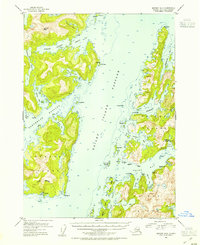
1952 Map of Seward B-3
USGS Topo · Published 1954About this map
Chenega Island and the sprawling Knight Island dominate this coastal survey of Prince William Sound, detailing a maritime landscape defined by deep fjords and isolated outposts. The settlement of Chenega is documented on the southwestern shore, adjacent to a village site and a local cemetery, providing critical evidence for researchers of Alutiiq history and ancestral sites before later decades brought major geographic changes.
Find a feature on this map
55 named features on this map. Tap any name to fly to it.
Don’t see what you’re looking for? This feature index may not catch every label — zoom into the map to look around manually.
Map Details
Editions of this 1952 Seward B-3 Map
2 editions found
Other maps of this area

1950 · Seward B-3
USGS Topo · 1:63,360

1951 · Seward
USGS Topo · 1:250,000

1951 · Seward A-2
USGS Topo · 1:63,360

1951 · Seward B-4
USGS Topo · 1:63,360

1951 · Seward A-3
USGS Topo · 1:63,360

1951 · Seward A-4
USGS Topo · 1:63,360

1951 · Seward B-2
USGS Topo · 1:63,360

1951 · Seward C-4
USGS Topo · 1:63,360

1951 · Seward C-3
USGS Topo · 1:63,360

1951 · Seward C-2
USGS Topo · 1:63,360