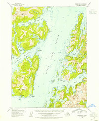
1952 Map of Seward B-3
USGS Topo · Published 1954About this map
The Alutiiq settlement of Chenega stands on the southern tip of Chenega Island, a focal point of this 1950s maritime survey. The map details the village infrastructure, including the Chenega Cem, before the devastating 1964 earthquake and tsunami fundamentally altered the community. Surrounding the village, the Chugach National Forest boundary tightly frames the exclusion area, while Dangerous Passage separates the island from the complex coastline to the north.
Find a feature on this map
58 named features on this map. Tap any name to fly to it.
Don’t see what you’re looking for? This feature index may not catch every label — zoom into the map to look around manually.
Map Details
Editions of this 1952 Seward B-3 Map
2 editions found

Other maps of this area

1950 · Seward B-3
USGS Topo · 1:63,360

1951 · Seward
USGS Topo · 1:250,000

1951 · Seward A-2
USGS Topo · 1:63,360

1951 · Seward B-4
USGS Topo · 1:63,360

1951 · Seward A-3
USGS Topo · 1:63,360

1951 · Seward A-4
USGS Topo · 1:63,360

1951 · Seward B-2
USGS Topo · 1:63,360

1951 · Seward C-4
USGS Topo · 1:63,360

1951 · Seward C-3
USGS Topo · 1:63,360

1951 · Seward C-2
USGS Topo · 1:63,360