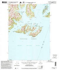
1995 Map of Seward D-1
USGS Topo · Published 1999About this map
Glacier Island dominates this maritime survey of Prince William Sound, where the complex coastline of the Chugach National Forest meets the sea. The map reveals a landscape defined by seasonal access and remote outposts, featuring a cabin and cabin ruins near a boat dock on the island's northern shore. Maritime navigation is central to the area, evidenced by the Alaska Marine Highway ferry route cutting through the sound and a light marking the eastern approach to Finski Bay. North of the island, the massive Columbia Bay opens toward the Iceberg Impoundment Area, suggesting the dynamic glacial environment that shapes these waters. Smaller features like Billys Hole and Fish Pass indicate localized naming of narrow passages and coves, while Heather Island and Schrader Island provide sheltered anchorages amidst the deep inlets.
Find a feature on this map
48 named features on this map. Tap any name to fly to it.
Don’t see what you’re looking for? This feature index may not catch every label — zoom into the map to look around manually.
Map Details
Editions of this 1995 Seward D-1 Map
This is the sole edition of this map. No revisions or reprints were ever made.
Other maps of this area

1948 · Cordova
USGS Topo · 1:250,000

1950 · Cordova C-8
USGS Topo · 1:63,360

1951 · Seward
USGS Topo · 1:250,000

1951 · Anchorage
USGS Topo · 1:250,000

1951 · Cordova
USGS Topo · 1:250,000

1951 · Seward D-2
USGS Topo · 1:63,360

1951 · Seward D-1
USGS Topo · 1:63,360

1951 · Cordova D-8
USGS Topo · 1:63,360

1951 · Seward C-1
USGS Topo · 1:63,360

1951 · Seward C-2
USGS Topo · 1:63,360