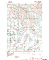
1984 Map of Bering Glacier D-3
USGS Topo · Published 1987About this map
Wrangell-Saint Elias National Park and the adjacent Wrangell-Saint Elias Wilderness dominate this high-altitude landscape in the mid-1980s. The terrain is defined by the massive glacial systems and jagged peaks of the Granite Range, where ice and rock meet at heights such as Mount Gage. This provisional survey, based on aerial photography from the 1970s, documents a vast expanse of unpopulated Alaskan wilderness devoid of roads or trails. Drainage patterns are sparse but distinct, with Goat Creek cutting through the northwestern section of the quadrangle. The map is a study in glaciology and alpine topography, showing the intricate contours of ice fields and moraines as they existed before decades of modern glacial retreat changed the face of the Wrangell Mountains.
Find a feature on this map
5 named features on this map. Tap any name to fly to it.
Don’t see what you’re looking for? This feature index may not catch every label — zoom into the map to look around manually.
Map Details
Editions of this 1984 Bering Glacier D-3 Map
2 editions found
Other maps of this area

1950 · Bering Glacier
USGS Topo · 1:250,000

1951 · McCarthy
USGS Topo · 1:250,000

1951 · Bering Glacier
USGS Topo · 1:250,000

1959 · McCarthy A-4
USGS Topo · 1:63,360

1959 · McCarthy A-2
USGS Topo · 1:63,360

1959 · McCarthy A-3
USGS Topo · 1:63,360

1959 · Bering Glacier
USGS Topo · 1:250,000

1960 · McCarthy
USGS Topo · 1:250,000
1984 · Bering Glacier D-2
USGS Topo · 1:63,360

1984 · Bering Glacier D-4
USGS Topo · 1:63,360