
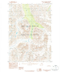
1984 Map of Bering Glacier D-4
USGS Topo · Published 1984About this map
The Kiagna River carves through the heart of this Alaskan interior landscape, flowing between the peaks of the Granite Range and Baldy Mountain. This 1984 provisional survey illustrates the high-elevation terrain within the Wrangell - Saint Elias National Park and the adjacent Wrangell - Saint Elias Wilderness, areas designated to preserve the vast glacial systems and alpine ecosystems of the region.
Find a feature on this map
8 named features on this map. Tap any name to fly to it.
Don’t see what you’re looking for? This feature index may not catch every label — zoom into the map to look around manually.
Map Details
Editions of this 1984 Bering Glacier D-4 Map
2 editions found
Other maps of this area

1950 · Bering Glacier
USGS Topo · 1:250,000

1951 · McCarthy
USGS Topo · 1:250,000

1951 · Bering Glacier
USGS Topo · 1:250,000

1959 · McCarthy A-4
USGS Topo · 1:63,360

1959 · McCarthy A-5
USGS Topo · 1:63,360

1959 · McCarthy A-3
USGS Topo · 1:63,360

1959 · Bering Glacier
USGS Topo · 1:250,000

1960 · McCarthy
USGS Topo · 1:250,000

1984 · Bering Glacier D-5
USGS Topo · 1:63,360
1984 · Bering Glacier D-3
USGS Topo · 1:63,360