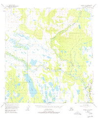
1950 Map of Gulkana C-4
USGS Topo · Published 1977About this map
Sourdough stands as the primary human landmark in this section of the Copper River Basin, situated at the confluence of Sourdough Creek and the Gulkana River. The 1950 data, updated with limited revisions in 1977, documents a critical era of infrastructure development in Alaska. This transition is most evident in the depiction of The Trans-Alaska Pipeline (Under Construction) running parallel to the established Richardson Highway. The landscape is dominated by the complex hydrology of the West Fork Gulkana River and extensive water bodies like Fish Lake and Canyon Lake. A lone Gaging Sta and a Campground near the river junction suggest the area's importance for both environmental monitoring and travel along the historic highway corridor during the mid-to-late twentieth century.
Find a feature on this map
13 named features on this map. Tap any name to fly to it.
Don’t see what you’re looking for? This feature index may not catch every label — zoom into the map to look around manually.
Map Details
Editions of this 1950 Gulkana C-4 Map
4 editions found
Other maps of this area

1949 · Gulkana D-3
USGS Topo · 1:63,360

1950 · Gulkana D-4
USGS Topo · 1:63,360

1950 · Gulkana B-3
USGS Topo · 1:63,360

1950 · Gulkana C-3
USGS Topo · 1:63,360

1950 · Gulkana C-4
USGS Topo · 1:63,360

1951 · Gulkana
USGS Topo · 1:250,000

1951 · Gulkana B-5
USGS Topo · 1:63,360

1951 · Gulkana D-5
USGS Topo · 1:63,360

1951 · Gulkana C-5
USGS Topo · 1:63,360

1951 · Gulkana B-4
USGS Topo · 1:63,360