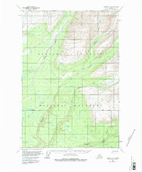
1959 Map of Valdez D-2
USGS Topo · Published 1980About this map
Wrangell-St Elias National Monument defines the geography of this 1959-annotated landscape, where glacial waters and seasonal routes carve through the interior. The Dadina River and Cheshnina River dominate the drainage patterns, feeding into a network of braided streams and forks. A lone Cabin and a remote Landing Strip represent the primary signs of human habitation in this wilderness, while the Winter Trail provides the only overland connectivity shown through the northern corridor. These sparse markers of settlement and transportation reflect the early administrative efforts by the Bureau of Land Management to document land units along the Base Line before more modern infrastructure reached the region. The map preserves a quiet moment in the Alaskan interior, centered on the confluence of the East Fork and the larger glacial river systems.
Find a feature on this map
10 named features on this map. Tap any name to fly to it.
Don’t see what you’re looking for? This feature index may not catch every label — zoom into the map to look around manually.
Map Details
Editions of this 1959 Valdez D-2 Map
2 editions found
Other maps of this area

1951 · Gulkana
USGS Topo · 1:250,000

1951 · Valdez C-2
USGS Topo · 1:63,360

1951 · Valdez C-3
USGS Topo · 1:63,360

1951 · Valdez C-1
USGS Topo · 1:63,360

1952 · Valdez
USGS Topo · 1:250,000

1953 · Valdez C-2
USGS Topo · 1:63,360

1953 · Valdez C-3
USGS Topo · 1:63,360

1953 · Valdez C-1
USGS Topo · 1:63,360

1958 · Valdez D-3
USGS Topo · 1:63,360

1959 · Valdez D-2
USGS Topo · 1:63,360