
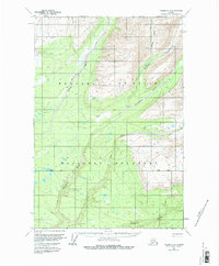
1959 Map of Valdez D-2
USGS Topo · Published 1964About this map
Glacial river valleys and high mountain drainage basins define this portion of the Copper River region, as mapped in the late 1950s. The landscape is dominated by a complex network of waterways, including the Dadina River and the Chetaslina River, which carve through the terrain alongside the Cheshnina River and Chitokna River. This remote Alaskan interior map provides an look at the region's limited infrastructure during the mid-century, characterized by a seasonal Winter Trail and a isolated Cabin located near the junction of the East Fork Chetaslina River. Evidence of early aviation and backcountry access is visible via a small Landing Strip situated near Sheep Gulch in the northeastern quadrant. The map serves as a primary record of the natural topography and the sparse human footprint in this wilderness area before more modern development reached the Alaskan interior.
Find a feature on this map
10 named features on this map. Tap any name to fly to it.
Don’t see what you’re looking for? This feature index may not catch every label — zoom into the map to look around manually.
Map Details
Editions of this 1959 Valdez D-2 Map
2 editions found
Other maps of this area

1951 · Gulkana
USGS Topo · 1:250,000

1951 · Valdez C-2
USGS Topo · 1:63,360

1951 · Valdez C-3
USGS Topo · 1:63,360

1951 · Valdez C-1
USGS Topo · 1:63,360

1952 · Valdez
USGS Topo · 1:250,000

1953 · Valdez C-2
USGS Topo · 1:63,360

1953 · Valdez C-3
USGS Topo · 1:63,360

1953 · Valdez C-1
USGS Topo · 1:63,360

1958 · Valdez D-3
USGS Topo · 1:63,360
1959 · Gulkana A-1
USGS Topo · 1:63,360