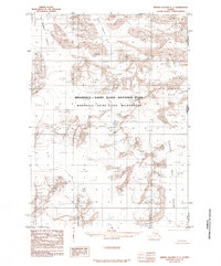
1985 Map of Bering Glacier C-1
USGS Topo · Published 1985About this map
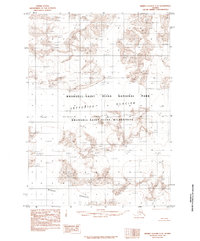
The massive ice fields of the Wrangell - Saint Elias National Park dominate this mid-1980s topographic survey, capturing a landscape defined by moving ice and international boundaries. The map documents the high-altitude terrain along the Alaska Yukon Territory line, where the United States Canada border meets the frozen expanse of the Wrangell - Saint Elias Wilderness. Glacial features are the primary focus, with the Baldwin Glacier and Fraser Glacier carving through the mountains to the north and west. In the eastern sector, the Quintino Sella Glacier marks the rugged transition toward the Canadian interior. This provisional edition was compiled from aerial photography from the early 1970s, providing a precise record of glacial positions and elevations before late-twentieth-century climatic shifts began to alter these ancient ice structures.
Find a feature on this map
8 named features on this map. Tap any name to fly to it.
Don’t see what you’re looking for? This feature index may not catch every label — zoom into the map to look around manually.
Map Details
Editions of this 1985 Bering Glacier C-1 Map
This is the sole edition of this map. No revisions or reprints were ever made.
Other maps of this area

1950 · Bering Glacier
USGS Topo · 1:250,000

1951 · Bering Glacier
USGS Topo · 1:250,000

1951 · Mt Saint Elias
USGS Topo · 1:250,000

1959 · Bering Glacier
USGS Topo · 1:250,000

1959 · Mt Saint Elias
USGS Topo · 1:250,000
1984 · Bering Glacier D-2
USGS Topo · 1:63,360
1984 · Bering Glacier D-1
USGS Topo · 1:63,360
1985 · Bering Glacier B-1
USGS Topo · 1:63,360
1985 · Bering Glacier C-2
USGS Topo · 1:63,360
1985 · Mount Saint Elias B-8
USGS Topo · 1:63,360