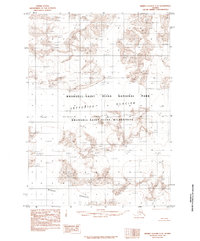
1985 Map of Bering Glacier C-2
USGS Topo · Published 1985About this map
Wrangell-Saint Elias National Park dominates this mid-1980s terrain, revealing a landscape defined by massive ice formations and the high-altitude wilderness of southern Alaska. Based on aerial photography from the early 1970s, the map provides a scientific record of the Bagley Icefield and its surrounding glacial systems before modern climatic shifts. The movement of ice is traced through the Jefferies Glacier, which flows through the heart of the Wrangell-Saint Elias Wilderness. Because there are no roads or trails in this area, the document focuses entirely on the natural topography and the township and range lines that grid the ice and rock. This survey serves as a fundamental baseline for understanding the glaciology of the Saint Elias Mountains during the late twentieth century.
Find a feature on this map
10 named features on this map. Tap any name to fly to it.
Don’t see what you’re looking for? This feature index may not catch every label — zoom into the map to look around manually.
Map Details
Editions of this 1985 Bering Glacier C-2 Map
This is the sole edition of this map. No revisions or reprints were ever made.
Other maps of this area

1950 · Bering Glacier
USGS Topo · 1:250,000

1951 · Bering Glacier
USGS Topo · 1:250,000

1959 · Bering Glacier
USGS Topo · 1:250,000
1984 · Bering Glacier D-2
USGS Topo · 1:63,360
1984 · Bering Glacier D-1
USGS Topo · 1:63,360
1984 · Bering Glacier D-3
USGS Topo · 1:63,360
1985 · Bering Glacier B-1
USGS Topo · 1:63,360
1985 · Bering Glacier C-1
USGS Topo · 1:63,360
1985 · Bering Glacier B-3
USGS Topo · 1:63,360
1985 · Bering Glacier B-2
USGS Topo · 1:63,360