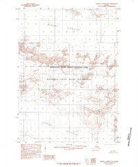
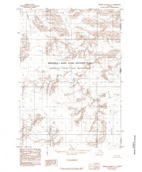
1985 Map of Bering Glacier B-2
USGS Topo · Published 1985About this map
Bagley Icefield dominates the northern landscape of this remote Alaskan terrain, where massive glacial formations have carved the earth over millennia. This 1985 provisional edition, based on aerial photography from the early 1970s, captures the frozen expanse within the Wrangell - Saint Elias National Park and the adjacent Wrangell - Saint Elias Wilderness. To the south, the Yahtse Glacier flows through the complex topography, illustrating the dynamic ice movements that define this region. The map is primarily a study of glaciology and elevation, documenting a wilderness area with no roads or trails, where the interplay of ice and high-altitude peaks is the primary geographic focus. Researchers can observe the intricate contour patterns that delineate the flow of numerous unnamed glaciers contributing to the larger ice fields.
Find a feature on this map
5 named features on this map. Tap any name to fly to it.
Don’t see what you’re looking for? This feature index may not catch every label — zoom into the map to look around manually.
Map Details
Editions of this 1985 Bering Glacier B-2 Map
This is the sole edition of this map. No revisions or reprints were ever made.
Other maps of this area

1950 · Bering Glacier A-3
USGS Topo · 1:63,360

1950 · Bering Glacier
USGS Topo · 1:250,000

1951 · Bering Glacier
USGS Topo · 1:250,000

1951 · Bering Glacier A-2
USGS Topo · 1:63,360

1959 · Bering Glacier
USGS Topo · 1:250,000
1959 · Bering Glacier A-3
USGS Topo · 1:63,360

1959 · Bering Glacier A-2
USGS Topo · 1:63,360
1985 · Bering Glacier B-1
USGS Topo · 1:63,360
1985 · Bering Glacier C-2
USGS Topo · 1:63,360
1985 · Bering Glacier C-1
USGS Topo · 1:63,360