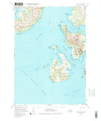
1951 Map of Cordova D-8
USGS Topo · Published 1976About this map
Tatitlek and Ellamar anchor the coastal landscape of Prince William Sound in this early 1950s survey. The map details the intricate shoreline of Valdez Arm and Port Fidalgo, where maritime activity is evidenced by the presence of a Seaplane Base near Virgin Bay. The interior is defined by sharp elevation changes, notably at Mt Freemantle and Ellamar Mountain, while Bligh Island sits prominently between the Tatitlek Narrows and the open waters of the sound.
Find a feature on this map
41 named features on this map. Tap any name to fly to it.
Don’t see what you’re looking for? This feature index may not catch every label — zoom into the map to look around manually.
Map Details
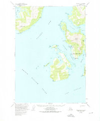
Editions of this 1951 Cordova D-8 Map
3 editions found
Other maps of this area

1948 · Cordova
USGS Topo · 1:250,000

1950 · Cordova C-7
USGS Topo · 1:63,360

1950 · Cordova D-7
USGS Topo · 1:63,360

1950 · Cordova C-8
USGS Topo · 1:63,360

1951 · Seward
USGS Topo · 1:250,000

1951 · Anchorage
USGS Topo · 1:250,000

1951 · Cordova
USGS Topo · 1:250,000

1951 · Seward D-1
USGS Topo · 1:63,360

1951 · Cordova D-8
USGS Topo · 1:63,360

1951 · Seward C-1
USGS Topo · 1:63,360