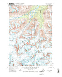
1951 Map of Valdez B-6
USGS Topo · Published 1975About this map
The Chugach Mountains dominate this high-altitude landscape, captured via aerial photography in 1950 and field-annotated by the U.S. Geological Survey in 1951. This survey reveals an environment defined entirely by glacial movement and vertical relief, where several massive ice fields converge. The Klutina Glacier and Valdez Glacier are shown in extensive detail, with numerous crevasses marked along their advancing fronts. From these ice masses, the Klutina River flows northward, fed by drainage from high summits like Mt Ourand and Mt Evans. The lack of any roads or trails on the sheet highlights the extreme isolation of this terrain during the mid-century. Mapping includes significant peaks such as Mt Schrader and Black Mtn, providing a precise record of the ice coverage and mountain topography as it existed before later decades of environmental change.
Find a feature on this map
16 named features on this map. Tap any name to fly to it.
Don’t see what you’re looking for? This feature index may not catch every label — zoom into the map to look around manually.
Map Details
Editions of this 1951 Valdez B-6 Map
3 editions found
Other maps of this area

1950 · Valdez C-6
USGS Topo · 1:63,360

1951 · Valdez B-5
USGS Topo · 1:63,360

1951 · Valdez C-5
USGS Topo · 1:63,360

1951 · Valdez B-6
USGS Topo · 1:63,360

1951 · Valdez A-6
USGS Topo · 1:63,360

1952 · Valdez
USGS Topo · 1:250,000

1952 · Valdez A-6
USGS Topo · 1:63,360

1953 · Valdez C-6
USGS Topo · 1:63,360

1953 · Valdez C-5
USGS Topo · 1:63,360

1953 · Valdez B-6
USGS Topo · 1:63,360