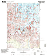
1995 Map of McCarthy C-7
USGS Topo · Published 2001About this map
Mount Blackburn dominates the northern skyline of this Alaskan wilderness, marking a landscape defined by massive glacial systems and high-altitude peaks. At the time of this mid-1990s update, the area was managed under several federal designations, including the Wrangell-Saint Elias National Park and the adjacent Wrangell-Saint Elias Wilderness. The mapping captures the immense scale of the Kennicott Glacier and Kuskulana Glacier, which carve through the high country toward the valley floors. Waterways like the Chokosna River and Lakina River drain the melting ice fields, fed by smaller tributaries such as Mill Creek and Hidden Creek. This survey reveals the transition from permanent ice and snow at Rime Peak to the braided river channels that dominate the lower elevations, illustrating the ongoing geological processes in one of the most protected environments in the United States.
Find a feature on this map
17 named features on this map. Tap any name to fly to it.
Don’t see what you’re looking for? This feature index may not catch every label — zoom into the map to look around manually.
Map Details
Editions of this 1995 McCarthy C-7 Map
This is the sole edition of this map. No revisions or reprints were ever made.
Other maps of this area

1951 · McCarthy
USGS Topo · 1:250,000

1951 · McCarthy C-8
USGS Topo · 1:63,360

1951 · McCarthy B-8
USGS Topo · 1:63,360

1959 · McCarthy B-6
USGS Topo · 1:63,360

1959 · McCarthy D-7
USGS Topo · 1:63,360

1959 · McCarthy C-6
USGS Topo · 1:63,360

1959 · McCarthy C-7
USGS Topo · 1:63,360

1959 · McCarthy B-7
USGS Topo · 1:63,360

1960 · McCarthy D-8
USGS Topo · 1:63,360

1960 · McCarthy D-6
USGS Topo · 1:63,360