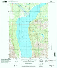
1993 Map of Valdez D-7
USGS Topo · Published 2001About this map
Tazlina Lake dominates the central landscape of this interior Alaskan region, serving as the basin for a complex system of glacial and mountain runoff. The waters of the Nelchina River enter the lake from the northwest, while tributary systems like Mendeltna Creek, Kaina Creek, and Tazlina Creek carve through the surrounding high-elevation terrain. This map, based on topography compiled in 1948 and updated with 1993 imagery, illustrates a vast wilderness largely devoid of modern development. Outside of a remote Cabin near the lake’s edge, the map highlights the raw hydrology of the Copper River basin, including the secluded High Lake set within the eastern mountains. The presence of the Base Line survey marker underscores the early efforts to chart and subdivide this remote frontier during the mid-20th century.
Find a feature on this map
8 named features on this map. Tap any name to fly to it.
Don’t see what you’re looking for? This feature index may not catch every label — zoom into the map to look around manually.
Map Details
Editions of this 1993 Valdez D-7 Map
This is the sole edition of this map. No revisions or reprints were ever made.
Other maps of this area

1949 · Gulkana A-5
USGS Topo · 1:63,360

1949 · Gulkana A-6
USGS Topo · 1:63,360

1949 · Valdez D-8
USGS Topo · 1:63,360

1949 · Valdez D-6
USGS Topo · 1:63,360

1949 · Valdez D-7
USGS Topo · 1:63,360

1950 · Valdez C-6
USGS Topo · 1:63,360

1951 · Gulkana
USGS Topo · 1:250,000

1951 · Valdez D-6
USGS Topo · 1:63,360

1951 · Valdez D-7
USGS Topo · 1:63,360

1952 · Valdez D-8
USGS Topo · 1:63,360