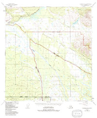
1948 Map of Nabesna C-6
USGS Topo · Published 1991About this map
The Slana settlement serves as a primary waypoint in this interior Alaskan landscape, situated where the Glenn Highway meets the headwaters of the Copper River. The map details a transition from the structured infrastructure of the Highway Maintenance Camp and Radio Tower near the highway to more isolated outposts like Duffys Tavern and the site at Batzulnetas. The convergence of Suslota and Suslositna Creek drainage systems toward Suslota Lake illustrates the complex hydrological network flowing from the Mentasta Mountains. This 1948 survey, revised in the early 1990s, documents the established boundaries of the Wrangell - St Elias National Park and preserve, marking a point in time when traditional sites like Old Suslota remained visible markers on the land alongside the gravel route of the Nabesna Road.
Find a feature on this map
32 named features on this map. Tap any name to fly to it.
Don’t see what you’re looking for? This feature index may not catch every label — zoom into the map to look around manually.
Map Details
Editions of this 1948 Nabesna C-6 Map
4 editions found
Other maps of this area

1948 · Nabesna C-6
USGS Topo · 1:63,360

1948 · Nabesna D-5
USGS Topo · 1:63,360

1949 · Nabesna D-6
USGS Topo · 1:63,360

1949 · Gulkana C-1
USGS Topo · 1:63,360

1950 · Nabesna
USGS Topo · 1:250,000

1950 · Nabesna D-5
USGS Topo · 1:63,360

1951 · Gulkana
USGS Topo · 1:250,000

1951 · Nabesna
USGS Topo · 1:250,000

1952 · Nabesna C-6
USGS Topo · 1:63,360

1952 · Nabesna D-5
USGS Topo · 1:63,360