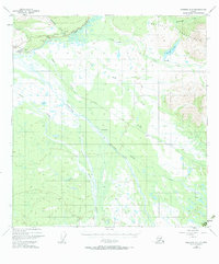
1948 Map of Nabesna C-6
USGS Topo · Published 1984About this map
The confluence of the Slana River and the Copper River serves as a focal point for this interior Alaskan landscape, where glacial runoff and mountain streams define the settlement patterns of the late 1940s. The northern reaches are dominated by the Mentasta Mountains, which overlook a network of water bodies including Suslota Lake and Suslositna Creek. Infrastructure is concentrated along the Glenn Highway, where the village of Slana and the Highway Maintenance Camp provide essential services for travelers and locals alike.
Find a feature on this map
24 named features on this map. Tap any name to fly to it.
Don’t see what you’re looking for? This feature index may not catch every label — zoom into the map to look around manually.
Map Details
Editions of this 1948 Nabesna C-6 Map
4 editions found
Other maps of this area

1948 · Nabesna C-6
USGS Topo · 1:63,360

1948 · Nabesna D-5
USGS Topo · 1:63,360

1949 · Nabesna D-6
USGS Topo · 1:63,360

1949 · Gulkana C-1
USGS Topo · 1:63,360

1950 · Nabesna
USGS Topo · 1:250,000

1950 · Nabesna D-5
USGS Topo · 1:63,360

1951 · Gulkana
USGS Topo · 1:250,000

1951 · Nabesna
USGS Topo · 1:250,000

1952 · Nabesna C-6
USGS Topo · 1:63,360

1952 · Nabesna D-5
USGS Topo · 1:63,360