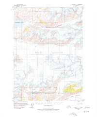
1959 Map of Cordova C-1
USGS Topo · Published 1977About this map
The glacial systems of the Chugach National Forest dominate this mid-century survey, revealing a landscape defined by massive ice movements and meltwater. The interaction between the Miles Glacier and Van Cleve Glacier creates a complex network of crevasses and topographical shifts near Van Cleve Lake. To the south, the Martin River Glacier and Johnson Glacier frame the southern edge of the quadrangle, while Slide Glacier occupies the high terrain in between. This map provides a detailed view of these ice bodies before more modern observations, capturing the specific extent of the glacial fronts and the indefinite National Forest Boundary as it was understood in the late 1950s.
Find a feature on this map
10 named features on this map. Tap any name to fly to it.
Don’t see what you’re looking for? This feature index may not catch every label — zoom into the map to look around manually.
Map Details
Editions of this 1959 Cordova C-1 Map
2 editions found

Other maps of this area

1948 · Cordova
USGS Topo · 1:250,000

1950 · Bering Glacier
USGS Topo · 1:250,000

1950 · Cordova B-2
USGS Topo · 1:63,360

1951 · Bering Glacier
USGS Topo · 1:250,000

1951 · Cordova
USGS Topo · 1:250,000

1951 · Cordova B-1
USGS Topo · 1:63,360

1953 · Cordova B-1
USGS Topo · 1:63,360

1953 · Cordova B-2
USGS Topo · 1:63,360

1959 · Cordova C-2
USGS Topo · 1:63,360

1959 · Cordova D-1
USGS Topo · 1:63,360