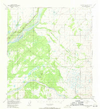
1949 Map of Gulkana B-2
USGS Topo · Published 1971About this map
The Copper River and its glacial-fed tributaries dominate this mid-century landscape of south-central Alaska. Surveyed in the late 1940s, the map highlights the critical corridor of the Glenn Highway as it parallels the river's western bank, providing a vital overland connection through this interior region. The drainage patterns are intricate, with the Sanford River carving a broad path toward the Copper River in the south, while smaller systems like Tulsona Creek and Little Tulsona Creek define the northern terrain. This survey was created using photogrammetric methods from 1949 aerial photography, capturing the remote area before modern expansion or infrastructure changes. In the northeast, the Yokneda Lakes and Billy Lake sit within a plateau of wetlands and varying elevations, illustrating the complex hydrography typical of the Copper River basin.
Find a feature on this map
8 named features on this map. Tap any name to fly to it.
Don’t see what you’re looking for? This feature index may not catch every label — zoom into the map to look around manually.
Map Details
Editions of this 1949 Gulkana B-2 Map
2 editions found
Other maps of this area

1949 · Gulkana A-3
USGS Topo · 1:63,360

1949 · Gulkana C-2
USGS Topo · 1:63,360

1949 · Gulkana B-2
USGS Topo · 1:63,360

1949 · Gulkana C-1
USGS Topo · 1:63,360

1950 · Gulkana B-3
USGS Topo · 1:63,360

1950 · Gulkana C-3
USGS Topo · 1:63,360

1951 · Gulkana
USGS Topo · 1:250,000

1952 · Gulkana A-3
USGS Topo · 1:63,360

1952 · Gulkana B-3
USGS Topo · 1:63,360

1952 · Gulkana B-2
USGS Topo · 1:63,360