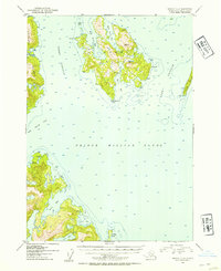
1952 Map of Seward C-3
USGS Topo · Published 1954About this map
Perry Island and its surrounding archipelago define this maritime survey of Prince William Sound, where the intricate coastline of Chugach National Forest was mapped just after the mid-century. The chart reveals a remote coastal landscape shaped by deep glacial bays and narrow waterways like Perry Passage and Lone Passage. Evidence of human activity is sparse but significant, marked by the presence of a Lighthouse Reserve and scattered Cabins along the shoreline, particularly near Lone Pt. The topography is defined by sharp elevation changes rising directly from the sea, with numerous inlets such as Main Bay, Foul Bay, and Falls Bay providing natural harbors. Large island masses like Culross Island and Lone Island dominate the sounds, while inland features such as Falls Lake show the transition from saltwater to the glaciated interior terrain typical of this Alaskan region in the early 1950s.
Find a feature on this map
25 named features on this map. Tap any name to fly to it.
Don’t see what you’re looking for? This feature index may not catch every label — zoom into the map to look around manually.
Map Details
Editions of this 1952 Seward C-3 Map
2 editions found

Other maps of this area

1950 · Seward B-3
USGS Topo · 1:63,360

1951 · Seward
USGS Topo · 1:250,000

1951 · Seward B-4
USGS Topo · 1:63,360

1951 · Seward D-2
USGS Topo · 1:63,360

1951 · Seward D-4
USGS Topo · 1:63,360

1951 · Seward B-2
USGS Topo · 1:63,360

1951 · Seward D-3
USGS Topo · 1:63,360

1951 · Seward C-4
USGS Topo · 1:63,360

1951 · Seward C-3
USGS Topo · 1:63,360

1951 · Seward C-2
USGS Topo · 1:63,360