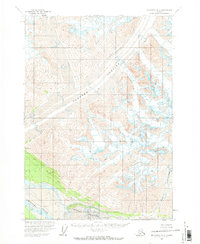
1959 Map of McCarthy A-2
USGS Topo · Published 1971About this map
Barnard Glacier dominates this landscape, its massive ice flow cutting a broad path toward the southwest through towering peaks. The 1959 survey records a wilderness shaped by high-altitude ice and the glacial-fed waters of the Chitina River. Along the northern banks of the river, the Huberts Landing Area represents one of the few signs of human activity in this unforgiving environment. The map provides clear evidence of the dynamic glacial system, specifically noting treacherous Crevasses and the convergence of several major ice fields, including the Chitina Glacier and the Ram Glacier. These features illustrate the natural drainage patterns where ice and meltwater transition into the river valley, a critical area for understanding the historical geography of this part of the Wrangell Mountains.
Find a feature on this map
9 named features on this map. Tap any name to fly to it.
Don’t see what you’re looking for? This feature index may not catch every label — zoom into the map to look around manually.
Map Details
Editions of this 1959 McCarthy A-2 Map
2 editions found
Other maps of this area

1950 · Bering Glacier
USGS Topo · 1:250,000

1951 · McCarthy
USGS Topo · 1:250,000

1951 · Bering Glacier
USGS Topo · 1:250,000

1959 · McCarthy A-2
USGS Topo · 1:63,360

1959 · McCarthy B-2
USGS Topo · 1:63,360

1959 · McCarthy B-1
USGS Topo · 1:63,360

1959 · McCarthy A-3
USGS Topo · 1:63,360
1959 · McCarthy A-1
USGS Topo · 1:63,360

1959 · Bering Glacier
USGS Topo · 1:250,000

1959 · McCarthy B-3
USGS Topo · 1:63,360