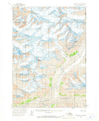
1959 Map of McCarthy A-1
USGS Topo · Published 1966About this map
Anderson Glacier and Tittmann Glacier dominate this remote Alaskan landscape, where the ice flows converge near the international border. Mapped in the late 1950s by the Usgs and the International Boundary Commission, this survey captures the frozen divide at Alaska Yukon. The high-altitude terrain is defined by massive peaks, including Mount Anderson and Mount Tittmann, which rise above heavily crevassed ice fields. The southern portion of the quadrangle is occupied by the broad expanse of the Chitina Glacier. This map provides a technical record of glacial extent and the United States Canada boundary line before modern satellite tracking, showing the distribution of crevasses and rock outcroppings near Mount George.
Find a feature on this map
9 named features on this map. Tap any name to fly to it.
Don’t see what you’re looking for? This feature index may not catch every label — zoom into the map to look around manually.
Map Details
Editions of this 1959 McCarthy A-1 Map
2 editions found
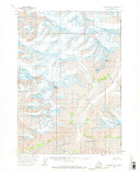
Other maps of this area

1950 · Bering Glacier
USGS Topo · 1:250,000

1951 · McCarthy
USGS Topo · 1:250,000

1951 · Bering Glacier
USGS Topo · 1:250,000

1951 · Mt Saint Elias
USGS Topo · 1:250,000

1959 · McCarthy A-2
USGS Topo · 1:63,360

1959 · McCarthy B-2
USGS Topo · 1:63,360

1959 · McCarthy B-1
USGS Topo · 1:63,360

1959 · Bering Glacier
USGS Topo · 1:250,000

1959 · Mt Saint Elias
USGS Topo · 1:250,000

1960 · McCarthy
USGS Topo · 1:250,000