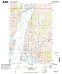
1993 Map of Valdez C-7
USGS Topo · Published 2002About this map
Tazlina Glacier dominates this landscape, its massive ice field marked by numerous crevasses as it flows between high mountain ridges. This 1993 planimetric update to the 1950 topography reveals the dynamic nature of the ice and water in this portion of the Copper River Meridian. Along the southern flank of the glacier, Iceberg Lake sits as a significant catchment, while the meltwater feeds into several important drainage systems. The Klutina River and Hallet River emerge from the high country, defining the valley floors and the local hydrology. This map is particularly useful for observing the drainage patterns of Kaina Creek and other unnamed tributaries that carve through the steep terrain, reflecting a purely natural environment shaped by glaciation and high-altitude runoff.
Find a feature on this map
7 named features on this map. Tap any name to fly to it.
Don’t see what you’re looking for? This feature index may not catch every label — zoom into the map to look around manually.
Map Details
Editions of this 1993 Valdez C-7 Map
This is the sole edition of this map. No revisions or reprints were ever made.
Other maps of this area

1949 · Valdez D-8
USGS Topo · 1:63,360

1949 · Valdez D-6
USGS Topo · 1:63,360

1949 · Valdez D-7
USGS Topo · 1:63,360

1950 · Valdez C-6
USGS Topo · 1:63,360

1951 · Valdez D-6
USGS Topo · 1:63,360

1951 · Valdez D-7
USGS Topo · 1:63,360

1951 · Valdez B-6
USGS Topo · 1:63,360

1952 · Valdez D-8
USGS Topo · 1:63,360

1952 · Valdez
USGS Topo · 1:250,000

1953 · Valdez C-6
USGS Topo · 1:63,360