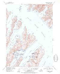
1952 Map of Seward A-3
USGS Topo · Published 1954About this map
Latouche Island and the surrounding Prince William Sound waterways reveal a specialized industrial landscape focused on copper mining and coastal processing. The settlement at Latouche serves as the focal point, situated near a series of mining operations including the Beatson Mine (Aband) and Blackbird Mine (Aband). This network of copper-rich land and deep-water passages supported a localized maritime economy, further evidenced by the San Juan Cannery and the settlement at Port Ashton on Evans Island. To the north, the massive Knight Island is bisected by numerous inlets such as Mummy Bay and Little Bay, while the Lighthouse Reserve at Pt Helen marks a critical navigation point. The presence of Girdwood (Aband) and various cabins scattered along the shoreline indicates a pattern of early 20th-century resource extraction and seasonal habitation that defined this reach of the Chugach National Forest.
Find a feature on this map
65 named features on this map. Tap any name to fly to it.
Don’t see what you’re looking for? This feature index may not catch every label — zoom into the map to look around manually.
Map Details
Editions of this 1952 Seward A-3 Map
2 editions found

Other maps of this area

1946 · Blying Sound
USGS Topo · 1:250,000

1950 · Seward B-3
USGS Topo · 1:63,360

1950 · Blying Sound D-4
USGS Topo · 1:63,360

1951 · Blying Sound
USGS Topo · 1:250,000

1951 · Seward
USGS Topo · 1:250,000

1951 · Seward A-2
USGS Topo · 1:63,360

1951 · Seward B-4
USGS Topo · 1:63,360

1951 · Seward A-3
USGS Topo · 1:63,360

1951 · Blying Sound D-1 and D-2
USGS Topo · 1:63,360

1951 · Seward A-4
USGS Topo · 1:63,360