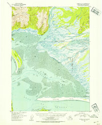
1953 Map of Cordova A-1
USGS Topo · Published 1954About this map
Controller Bay and the vast tidal mudflats of the Alaska coast dominate this early 1950s survey. The landscape is defined by the heavy glacial drainage of the Bering River and Nichawak River, which feed into a complex network of sloughs and channels. On the mainland, the settlement of Chilkat and an abandoned Cannery speak to the region's historical reliance on the sea. The map details a wild, changing coastline where the Okalee R meets the Gulf of Alaska behind the protective barrier of Okalee Spit.
Find a feature on this map
36 named features on this map. Tap any name to fly to it.
Don’t see what you’re looking for? This feature index may not catch every label — zoom into the map to look around manually.
Map Details
Editions of this 1953 Cordova A-1 Map
2 editions found
Other maps of this area

1948 · Cordova
USGS Topo · 1:250,000

1948 · Middleton Island
USGS Topo · 1:250,000

1950 · Middleton Island
USGS Topo · 1:250,000

1950 · Bering Glacier
USGS Topo · 1:250,000

1950 · Icy Bay
USGS Topo · 1:250,000

1950 · Cordova B-2
USGS Topo · 1:63,360

1950 · Cordova A-1
USGS Topo · 1:63,360

1950 · Cordova A-2
USGS Topo · 1:63,360

1951 · Icy Bay
USGS Topo · 1:250,000

1951 · Bering Glacier
USGS Topo · 1:250,000