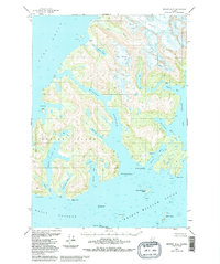
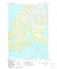
1951 Map of Seward D-3
USGS Topo · Published 1988About this map
Esther Island and its surrounding glacial waters dominate this mid-century view of the Chugach National Forest. The intricate coastline is marked by deep incisions such as Esther Passage and Esther Bay, where the shoreline meets the high relief of the interior. To the north, the massive ice flows of Crescent Glacier, Tommy Glacier, and Eaglek Glacier descend toward the sea, feeding the Avery River and various coastal inlets.
Find a feature on this map
53 named features on this map. Tap any name to fly to it.
Don’t see what you’re looking for? This feature index may not catch every label — zoom into the map to look around manually.
Map Details
Editions of this 1951 Seward D-3 Map
6 editions found
Other maps of this area

1951 · Seward
USGS Topo · 1:250,000

1951 · Anchorage
USGS Topo · 1:250,000

1951 · Seward D-2
USGS Topo · 1:63,360

1951 · Seward D-4
USGS Topo · 1:63,360

1951 · Seward D-3
USGS Topo · 1:63,360

1951 · Seward C-4
USGS Topo · 1:63,360

1951 · Seward C-3
USGS Topo · 1:63,360

1951 · Seward C-2
USGS Topo · 1:63,360

1952 · Seward D-3
USGS Topo · 1:63,360

1952 · Seward C-3
USGS Topo · 1:63,360