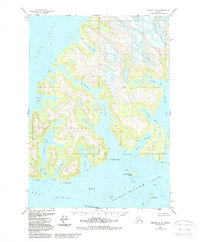
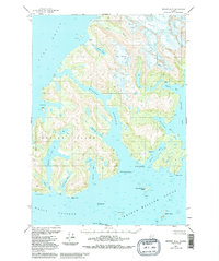
1951 Map of Seward D-3
USGS Topo · Published 1988About this map
Esther Island and the surrounding reaches of Prince William Sound define this coastal landscape, mapped using 1949 aerial photography and 1951 field annotations. The sheet captures the intricate coastline of the Chugach National Forest before the tectonic shifts of the 1964 earthquake altered the region's topography. Navigational markers like the Esther Island Light provide essential reference points along Wells Passage and Port Wells.
Find a feature on this map
30 named features on this map. Tap any name to fly to it.
Don’t see what you’re looking for? This feature index may not catch every label — zoom into the map to look around manually.
Map Details
Editions of this 1951 Seward D-3 Map
6 editions found
Other maps of this area

1951 · Seward
USGS Topo · 1:250,000

1951 · Anchorage
USGS Topo · 1:250,000

1951 · Seward D-2
USGS Topo · 1:63,360

1951 · Seward D-4
USGS Topo · 1:63,360

1951 · Seward D-3
USGS Topo · 1:63,360

1951 · Seward C-4
USGS Topo · 1:63,360

1951 · Seward C-3
USGS Topo · 1:63,360

1951 · Seward C-2
USGS Topo · 1:63,360

1952 · Seward D-3
USGS Topo · 1:63,360

1952 · Seward C-3
USGS Topo · 1:63,360