
1953 Map of Cordova D-6
USGS Topo · Published 1954About this map
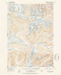
The northern reaches of the Prince William Sound region are defined here by the deep coastal indentations of Port Fidalgo and Port Gravina. Captured in the early 1950s, the landscape shows a complex network of glacial activity and tidal flats, with numerous crevasses marking the high ice fields and significant mud deposits at the heads of the bays. Human presence is sparse, limited to a single Cabin on the north shore of Port Fidalgo and several geodetic survey markers like VABM Duck 10 and VABM Elf 6. Much of the territory falls within the Chugach National Forest Boundary, where the Gravina River flows into its namesake port. The map serves as a detailed record of the shoreline before modern development, documenting the natural drainages of Dead Creek and the sheltered waters of Whalen Bay and Beartrap Bay.
Find a feature on this map
16 named features on this map. Tap any name to fly to it.
Don’t see what you’re looking for? This feature index may not catch every label — zoom into the map to look around manually.
Map Details
Editions of this 1953 Cordova D-6 Map
2 editions found
Other maps of this area

1948 · Cordova
USGS Topo · 1:250,000

1950 · Cordova C-7
USGS Topo · 1:63,360

1950 · Cordova C-6
USGS Topo · 1:63,360

1950 · Cordova D-7
USGS Topo · 1:63,360

1950 · Cordova D-5
USGS Topo · 1:63,360

1951 · Cordova
USGS Topo · 1:250,000

1951 · Cordova C-5
USGS Topo · 1:63,360

1951 · Cordova D-6
USGS Topo · 1:63,360

1951 · Valdez A-6
USGS Topo · 1:63,360

1952 · Valdez
USGS Topo · 1:250,000