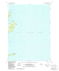
1951 Map of Seward C-1
USGS Topo · Published 1988About this map
Naked Island and its smaller neighbors dominate this maritime landscape within the Chugach National Forest. Situated in the central waters of Prince William Sound, the topography transitions from the high peaks of Peak Island and the rugged interior of Naked Island down to the deeply indented shoreline of McPherson Bay. The survey records several navigational and survey markers, including Abner, Cadet, and Edgar, alongside a designated Lighthouse Reserve on the northern tip of Smith Island. The complex network of waterways, such as Liljegren Passage and McPherson Passage, reflects the area's significance for coastal transit and protected anchorage in a region defined by its isolation and maritime character.
Find a feature on this map
20 named features on this map. Tap any name to fly to it.
Don’t see what you’re looking for? This feature index may not catch every label — zoom into the map to look around manually.
Map Details
Editions of this 1951 Seward C-1 Map
2 editions found
Other maps of this area

1948 · Cordova
USGS Topo · 1:250,000

1950 · Cordova C-8
USGS Topo · 1:63,360

1951 · Seward
USGS Topo · 1:250,000

1951 · Cordova
USGS Topo · 1:250,000

1951 · Seward B-1
USGS Topo · 1:63,360

1951 · Seward D-2
USGS Topo · 1:63,360

1951 · Seward D-1
USGS Topo · 1:63,360

1951 · Seward B-2
USGS Topo · 1:63,360

1951 · Cordova D-8
USGS Topo · 1:63,360

1951 · Seward C-1
USGS Topo · 1:63,360