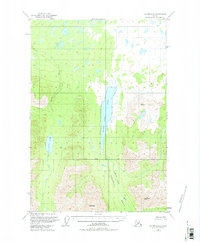
1949 Map of Valdez D-6
USGS Topo · Published 1974About this map
Saint Anne Lake dominates the central corridor of this interior Alaskan landscape, surveyed just after the late 1940s. The terrain transitions from the water-pocked lowlands in the north to the sharp elevations of the Copper River region. The mapping reveals a wilderness structured by water and peak, where Kaina Creek feeds into the elongated Kaina Lake to the west.
Find a feature on this map
9 named features on this map. Tap any name to fly to it.
Don’t see what you’re looking for? This feature index may not catch every label — zoom into the map to look around manually.
Map Details
Editions of this 1949 Valdez D-6 Map
2 editions found
Other maps of this area

1948 · Valdez D-5
USGS Topo · 1:63,360

1949 · Gulkana A-5
USGS Topo · 1:63,360

1949 · Valdez D-6
USGS Topo · 1:63,360

1949 · Valdez D-7
USGS Topo · 1:63,360

1950 · Valdez C-6
USGS Topo · 1:63,360

1951 · Valdez D-5
USGS Topo · 1:63,360

1951 · Gulkana
USGS Topo · 1:250,000

1951 · Valdez D-6
USGS Topo · 1:63,360

1951 · Valdez D-7
USGS Topo · 1:63,360

1951 · Gulkana A-4
USGS Topo · 1:63,360