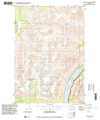
1995 Map of Valdez B-3
USGS Topo · Published 2002About this map
Wrangell-St Elias National Park dominates the southeastern quadrant of this terrain, where the Copper River flows along the Wrangell-St Elias National Park Boundary. The landscape is defined by the glacial drainage patterns of the Uranatina River and the Little Tonsina River, along with various creeks such as Mosquito Creek and Ernestine Creek. Human presence is concentrated along the western edge, following the corridor of the Richardson Highway.
Find a feature on this map
19 named features on this map. Tap any name to fly to it.
Don’t see what you’re looking for? This feature index may not catch every label — zoom into the map to look around manually.
Map Details
Editions of this 1995 Valdez B-3 Map
This is the sole edition of this map. No revisions or reprints were ever made.
Other maps of this area

1950 · Valdez A-3
USGS Topo · 1:63,360

1951 · Valdez B-2
USGS Topo · 1:63,360

1951 · Valdez B-3
USGS Topo · 1:63,360

1951 · Valdez C-2
USGS Topo · 1:63,360

1951 · Valdez C-3
USGS Topo · 1:63,360

1951 · Valdez C-4
USGS Topo · 1:63,360

1951 · Valdez B-4
USGS Topo · 1:63,360

1951 · Valdez A-2
USGS Topo · 1:63,360

1952 · Valdez
USGS Topo · 1:250,000

1953 · Valdez C-2
USGS Topo · 1:63,360