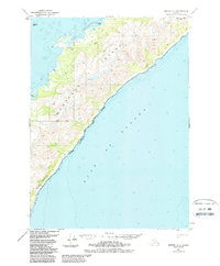
1951 Map of Seward A-1
USGS Topo · Published 1988About this map
Montague Island dominates this maritime landscape along the northeast entry to Prince William Sound, as documented through aerial photography and field annotation. The terrain is defined by the steep elevation of Zaikof Peak and the southern exposure of Purple Bluff Falls facing the open Gulf of Alaska. Near the northern sheltered waters of Port Chalmers, a Gaging Sta and small landforms like Wilby Island and Channel Island suggest the remote utility of this coastal reach during the mid-20th century.
Find a feature on this map
14 named features on this map. Tap any name to fly to it.
Don’t see what you’re looking for? This feature index may not catch every label — zoom into the map to look around manually.
Map Details
Editions of this 1951 Seward A-1 Map
4 editions found

Other maps of this area

1946 · Blying Sound
USGS Topo · 1:250,000

1948 · Cordova
USGS Topo · 1:250,000

1948 · Middleton Island
USGS Topo · 1:250,000

1950 · Middleton Island
USGS Topo · 1:250,000

1951 · Blying Sound
USGS Topo · 1:250,000

1951 · Seward
USGS Topo · 1:250,000

1951 · Cordova
USGS Topo · 1:250,000

1951 · Seward B-1
USGS Topo · 1:63,360

1951 · Seward A-2
USGS Topo · 1:63,360

1951 · Blying Sound D-1 and D-2
USGS Topo · 1:63,360