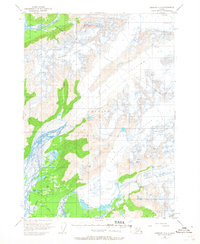
1950 Map of Cordova C-4
USGS Topo · Published 1968About this map
Shephard Glacier and the massive ice fields of the Chugach National Forest dominate this mid-century landscape east of the Copper River delta. The survey reveals a dynamic glacial environment, heavily marked with crevasses and calving into a complex network of freshwater bodies and drainage streams. To the south and west, the ice retreats into a labyrinth of lakes and ponds, including Lake Elsner, Beaver Lake, and the uniquely named Siamese Lakes.
Find a feature on this map
23 named features on this map. Tap any name to fly to it.
Don’t see what you’re looking for? This feature index may not catch every label — zoom into the map to look around manually.
Map Details
Editions of this 1950 Cordova C-4 Map
2 editions found
Other maps of this area

1948 · Cordova
USGS Topo · 1:250,000

1950 · Cordova C-4
USGS Topo · 1:63,360

1950 · Cordova D-3
USGS Topo · 1:63,360

1950 · Cordova D-5
USGS Topo · 1:63,360

1951 · Cordova
USGS Topo · 1:250,000

1951 · Cordova B-4
USGS Topo · 1:63,360

1951 · Cordova C-5
USGS Topo · 1:63,360

1951 · Cordova B-5
USGS Topo · 1:63,360

1951 · Cordova C-3
USGS Topo · 1:63,360

1951 · Cordova D-4
USGS Topo · 1:63,360